Publications
Greenbelt Historic District Draft Design Guidelines
Title:
Greenbelt Historic District Draft Design Guidelines
Author:
The Maryland-National Capital Park and Planning Commission
Prince George's County Planning Department
Publication Date:
01/01/1997
Source of Copies:
The Maryland-National Capital Park and Planning Commission
14741 Governor Oden Bowie Drive
Upper Marlboro, MD 20772
Number of Pages:
160
This document uses text and illustrations to describe the goals, concepts and guidelines of the local historic district designation process as they would affect a potential historic district focused on the planned community of Greenbelt. The document is divided into three parts. Part I of the document provides background information that addresses basic procedural questions about the purpose, function and procedures of a potential Greenbelt historic district. Part I also contains a number of recommendations regarding a potential locally designated Greenbelt Historic District including a boundary proposal and map, and a potential design review process. Part II contains an analysis of the historic and architectural significance of the planned community that is the basis for the potential district. Part III contains a set of design guidelines that could be used in the administration of an historic district.
Mount Rainier Historic District National Register Nomination
Title:
Mount Rainier Historic District National Register Nomination
Author:
The Maryland-National Capital Park and Planning Commission
Prince George's County Planning Department
Publication Date:
06/01/1989
Source of Copies:
The Maryland-National Capital Park and Planning Commission
14741 Governor Oden Bowie Drive
Upper Marlboro, MD 20772
Number of Pages:
147
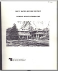
This publication documents the architectural and physical character and significance of 1,152 buildings within the Mount Rainier National Register Historic District. The nomination’s two primary sections, Description and Statement of Significance, are annotated, and illustrated with photographs and maps. ‘. The Mount Rainier Historic District is significant as an early, large – and essentially intact example of the type of suburban community that changed the character of western Prince George’s County in the early years of the 20th century. The historic district is also significant for its large and diverse collection of vernacular dwellings and commercial buildings erected between c. 1900 and 1939. Most of the district’s buildings are modestly scaled, detached, single family, frame houses. Throughout the district, buildings were erected with both subtle and substantial differences. These differences represent the evolution and diversity of vernacular design throughout the early years of the 20th century. In addition, there is an important group of five revival style churches designed by local architects. At least one of the churches is the work of a firm nationally known for its ecclesiastical buildings. The district’s period of significance, 1900 to 1939, represents a time of substantial suburban growth for the western portion of Prince George’s County as part of the Washington, D.C., metropolitan area.
Download not available.
Document not available for download.
Minor Public Facility Amendments (Approved)
Title:
Minor Public Facility Amendments (Approved)
Author:
The Maryland-National Capital Park and Planning Commission
Prince George's County Planning Department
Publication Date:
06/01/2002
Source of Copies:
The Maryland-National Capital Park and Planning Commission
14741 Governor Oden Bowie Drive
Upper Marlboro, MD 20772
Number of Pages:
20
This document contains text and maps in support of three proposed amendments to the 1990 Approved Largo-Lottsford Master Plan, the 1993 Approved Landover and Vicinity Master Plan, and the Master Plan of Transportation. The three proposed amendments were recommendations of the MD 202 Corridor Study, which was completed in 1997 with the cooperation of citizen groups and developer representatives. The amendments specifically under consideration would include the following: (a) the conversion of the I-95/I-495/Arena Drive interchange to full-time operation; (b) the deletion of the planned MD 202/Lottsford Road interchange in favor of an at-grade intersection; and (c) the deletion of the planned I-95/I-495/Campus Way interchange in favor of retaining an overpass, with no access to the Capital Beltway, at this location. In response to the desire of citizen groups who participated in the effort, the Planning Board and the District Council have initiated a minor public facility amendment process to further study these changes. This document only addresses the three amendments under study; it does not make any recommendations concerning the zoning of property nor does it contain any recommendations concerning nontransportation planning issues. Consideration of these three proposed amendments will be the initial step toward implementing the recommendations of the MD 202 Corridor Study.
Related Documents:
Melwood-Westphalia Approved Master Plan and Sectional Map Amendment
Title:
Melwood-Westphalia Approved Master Plan and Sectional Map Amendment
Author:
The Maryland-National Capital Park and Planning Commission
Prince George's County Planning Department
Publication Date:
03/01/1994
Source of Copies:
The Maryland-National Capital Park and Planning Commission
14741 Governor Oden Bowie Drive
Upper Marlboro, MD 20772
Number of Pages:
234
This document contains maps and supporting text of the Approved Master Plan and Sectional Map Amendment for Melwood- Westphalia (planning Areas 77 and 78). The Plan supersedes that part of the 1973 Subregion VI Master Plan and the 1980 Melwood Special Treatment Area Plan. The Plan is an amendment to The General Plan for the Maryland-Washington Regional District within Prince George’s County, Maryland, approved by the District Council in 1982; the 1982 Master Plan of Transportation, the 1983 Functional Master Plan for Public School Sites; the 1990 Public Safety Master Plan; the 1975 Countywide Trails Plan and the 1985 Equestrian Addendum. Developed by the Commission with the assistance of the Melwood-Westphalia Citizens’ Advisory Committee, this Plan contains information on existing plans of the area, existing land use and zoning characteristics, and the history. Goals, objectives, background/basic issues, concepts, recommendations and guidelines for the nine major chapters set forth are: Historic Preservation, Environmental Envelope, Sand and Gravel, Residential Areas, Commercial Areas and Activity Centers, Employment Areas, Impact of AAFB, Circulation and Transportation, and Public Facilities. Major recommendations are preservation of natural assets as part of the development process; extraction of sand and gravel deposits with appropriate reclamation prior to permanent development; preservation of historic resources; development of a planned community; protection of established residential communities; expansion of employment areas; provision of an efficient transportation system; provision of _ adequate park system and other public facilities to meet local needs; and recommendations to amend or enact regulations to achieve land use compatibility with Andrews Air Force Base. The Sectional Map Amendment includes the approved zoning changes which are designed to implement the Plan’s land use recommendations.
Greater Upper Marlboro Revitalization and Redevelopment Strategy
Title:
Greater Upper Marlboro Revitalization and Redevelopment Strategy
Author:
The Maryland-National Capital Park and Planning Commission
Prince George's County Planning Department
Publication Date:
05/01/2012
Source of Copies:
The Maryland-National Capital Park and Planning Commission
14741 Governor Oden Bowie Drive
Upper Marlboro, MD 20772
Number of Pages:
138
The Greater Upper Marlboro Revitalization and Redevelopment Strategy comprises text, maps, illustrations, and photographs. Developed with public participation by community business and property owners, this document presents background information and recommends goals, strategies, and actions pertaining to land use, environment, recreation, and public facilities.
Related Documents:
Greater Chillum Community Study
Title:
Greater Chillum Community Study
Author:
The Maryland-National Capital Park and Planning Commission
Prince George's County Planning Department
Publication Date:
12/01/2015
Source of Copies:
The Maryland-National Capital Park and Planning Commission
14741 Governor Oden Bowie Drive
Upper Marlboro, MD 20772
Number of Pages:
180
This study was initiated to investigate the needs of the Greater Chillum Community and prepare guidance to assist Prince George’s County and The Maryland-National Capital Park and Planning Commission with implementation approaches. The study area is located in an unincorporated region of Prince George’s County, east of the City of Takoma Park (Montgomery County), south of Langley Park, west of the City of Hyattsville, and north of the District of Columbia. The project concentrates on developing a comprehensive list of needs and improvement strategies with an emphasis on defining and facilitating neighborhood conservation, pedestrian safety and access, and commercial revitalization strategies and programs.
Medical Mall Planning Study Feasibility of Four Different Medical Malls In Prince George's County
Title:
Medical Mall Planning Study Feasibility of Four Different Medical Malls In Prince George's County
Author:
The Maryland-National Capital Park and Planning Commission
Prince George's County Planning Department
Publication Date:
12/01/2007
Source of Copies:
The Maryland-National Capital Park and Planning Commission
14741 Governor Oden Bowie Drive
Upper Marlboro, MD 20772
Number of Pages:
186
The prospects for establishing one or more medical malls in Prince George’s County have been discussed for several years. Several County Council persons, particularly Councilperson Tony Knotts, took the leadership in establishing a study of the feasibility of one or more medical malls in the County. This document reports the results of that study.
Walker Mill Community I - Recreational Facilities Study
Title:
Walker Mill Community I - Recreational Facilities Study
Author:
The Maryland-National Capital Park and Planning Commission
Publication Date:
03/01/1995
Source of Copies:
The Maryland-National Capital Park and Planning Commission
14741 Governor Oden Bowie Drive
Upper Marlboro, MD 20772
Number of Pages:
76
The project is designed to assist in the provision of safe recreational opportunities for young people in the Foxglenn, Joel and Walker Mill Gardens apartments areas.
Related Documents:
Urban Agriculture: A Tool for Creating Economic Development and Healthy Communities in Prince George's County, MD

Title:
Urban Agriculture: A Tool for Creating Economic Development and Healthy Communities in Prince George's County, MD
Author:
The Maryland-National Capital Park and Planning Commission
Prince George's County Planning Department
Publication Date:
09/01/2012
Source of Copies:
The Maryland-National Capital Park and Planning Commission
14741 Governor Oden Bowie Drive
Upper Marlboro, MD 20772
Number of Pages:
168
This report introduces the concept of urban agriculture, presents its characteristics, and discusses its relationship to food system planning, sustainability, and public health. A sample of innovative community-based urban agriculture projects around the nation and in Prince George’s County serves to show the hands-on implementation of the concept. Planning and public policy for urban agriculture are discussed along with possible actions that planners and policy makers may take to support it. This is supplemented by the nation’s best local government practices for incorporating urban agriculture into urban and suburban areas. Guided by the experience of other jurisdictions, specific policy recommendations suited to Prince George’s County are developed and presented along with strategies in the concluding chapter of the report.
Related Documents:
Visual Guide to Zoning Categories (December 2024)
Title:
Visual Guide to Zoning Categories (December 2024)
Author:
The Maryland-National Capital Park and Planning Commission
Prince George's County Planning Department
Publication Date:
11/01/2024
Source of Copies:
The Maryland-National Capital Park and Planning Commission
1616 McCormick Drive
Largo, MD 20774
Number of Pages:
16
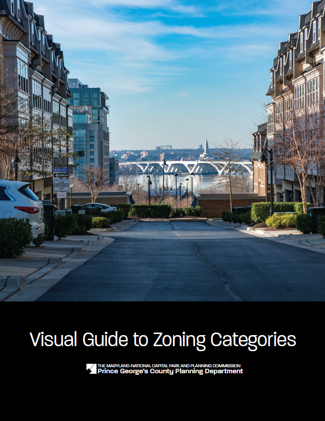
The Visual Guide to Zoning Categories represents the new Prince George’s County Zoning Ordinance zoning categories following the update to the zoning code in 2022.



 Historic Contexts in Prince Georges County Short Papers on Settlement Patterns Transportation and Cultural History June 1990 - August 1991