Berwyn Heights NW Corridor Economic Development Strategy (PAMC)
Berwyn Heights NW Corridor Economic Development Strategy (PAMC)
Project Planner
Planner III, Neighborhood Revitalization Section
PHONE: 301-952-4609
EMAIL: connor.klein@ppd.mncppc.org
Updates
The Market Conditions Assessment for this project was presented to the Berwyn Heights Town Council on April 6th at 7 p.m. See the presentation to the Town Council in the following link: Council Presentation
Project Description
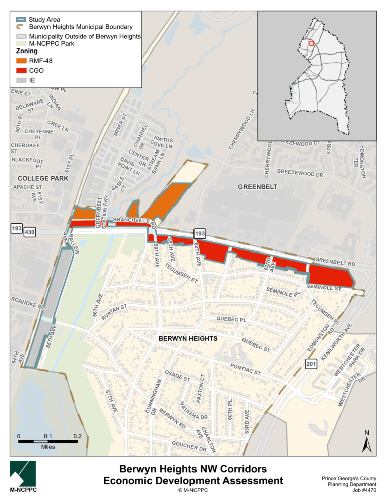
Lands with zones in Berwyn Heights conducive to development—IE (Industrial, Employment), RMF-48 (Residential, Multifamily-48), and CGO (Commercial, General and Office)—are found in the Town’s northwest corridors: Greenbelt Road to the north and Ballew Avenue to the west. The Town of Berwyn Heights is seeking to examine these commercial corridors and analyze the local economic context; identify economic opportunities and resources; and collaborate with stakeholders to anticipate needs and opportunities created by the Beltway Plaza redevelopment and the potential FBI headquarters facility (֫in Greenbelt.) This project would analyze, interpret, and understand the current market and economic conditions of the study area in these zones, develop a report that details the capacity of the study area for economic growth and provide recommendations to improve upon and advance the interests of not only the Town of Berwyn Heights but those of the adjacent cites—College Park and Greenbelt.
The project’s aim is to produce a detailed report outlining the Town’s capacity for economic growth along these corridors and to offer strategic recommendations for enhancing the community’s economic prospects. The assessment will propose actionable strategies for the municipality to foster sustainable quality economic development. The assessment will be developed using County data, contributions from city staff and elected officials, business and property owners, field surveys, and analysis and interpretation by the consultant. The final work product will take the form of a report.
Project Boundary
TBA
Timeline
TBA