Minor Amendment to the Subregion 6 Master Plan and SMA
Minor Amendment to the Subregion 6 Master Plan and SMA

Project Contact Information
Kierre McCune
TEL: 301-952-3211
EMAIL: kierre.mccune@ppd.mncppc.org
Korey Arsenault
TEL: 301-952-4317
EMAIL: korey.arsenault@ppd.mncppc.org
Land Use & Zoning Analysis
Stantec, the consultant lead, reviewed existing land-use patterns and policy, zoning, and recent development activity within the Subregion. The Subregion has the opportunity to re-algin zoning in key locations to improve economic development, retail opportunities, and job creation while retaining the low-density agricultural character of the Subregion.
View the Land Use and Zoning Analysis here.
Community Listening Session Summary
The Subregion 6 project team hosted Community Listening Sessions on November 10th and 13th. View the presentation and context boards to learn more. For residents and stakeholders unable to attend the listening session and for listening session participants who wanted to provide additional information, the planning team published an online survey.
The summary document below outlines the findings of the Community Listening Sessions and the Survey. This input will directly guide the Minor Plan Amendment.
View the Listening Session Summary here.
Agriculture Listening Session Summary
In December 2025, the Subregion 6 Minor Plan Amendment team worked with the Subregion 1 and Subregion 5 Minor Plan Amendments project team to host a Listening Session specifically geared toward the agricultural community to inform updates for all three amendments. View the presentation and context boards to learn more.
The summary document below outlines the findings of the Agriculture Listening Session. This input will directly guide the Minor Plan Amendment.
View the Agriculture Listening Session Summary here.
Read the Market Study
The consultant team, RCLCO, conducted a robust analysis of the economic strengths and opportunities within Subregion 6. The market study’s key objectives were:
- Looking at what industries we have now and what the market can support in the future (like offices, retail, hospitality, and flex/industrial uses).
- Confirming the level of demand for products such as agritech, agritourism, regional entertainment, makerspaces, and Fortune 500 Company offices.
- Understanding what makes different businesses likely to locate in an area.
- Identifying what uses the market would support at key locations within the Subregion.
The Prince George’s County Planning Department is preparing an amendment to the approved 2013 Subregion 6 Master Plan and Sectional Map Amendment. This minor plan amendment is intended to establish a forward-looking, market-viable framework that enables investment and economic development while enhancing the quality of life for residents and workers in the area.
The plan amendment will combine public participation, real estate market analysis, land use and zoning review, and regional best practices to shape updated planning recommendations. The recommendations will be grouped into plan elements such as land use, open space, economic development, housing, and transportation. Together, these efforts will help recalibrate growth, development scale, and infrastructure needs to align with current conditions, community priorities, and reflect the guidance of the General Plan (Plan 2035)
Subregion 6 covers approximately 151 square miles, or about 31 percent of the county’s total land area. While the subregion includes suburban areas and two incorporated towns (Eagle Harbor and Upper Marlboro, the County seat), it is distinguished by its large rural portions in the southeast, along the Patuxent River. Subregion 6 provides a transition from urbanized areas of Prince George’s County to the rural counties of southern Maryland.
The Subregion 6 Master Plan update is being carried out in tandem with the minor plan amendment for Subregion 5, which is adjacent to Subregion 6.
The planning process will feature three listening sessions, offering opportunities for residents, businesses, and stakeholders to share their preferences and priorities for the scale, character, and implementation of future development in Subregion 6.
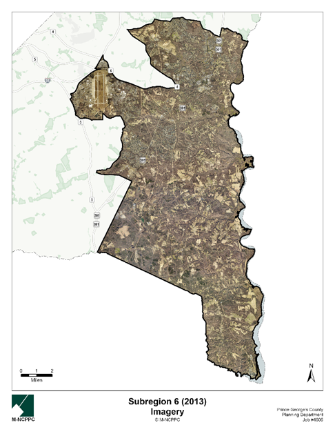
Project Boundary Map
Timeline
| Milestone | Expected Timelines |
|---|---|
Listening Sessions | Fall 2025 |
| Initiation | Spring 2026 |
| Joint Public Hearing | Summer 2026 |
| Planning Board Adoption | Summer 2026 |
| Council Approval | Fall 2026 |
FAQs
How can I participate in the planning process?
This planning process features a unique community engagement approach designed to specifically capture resident and stakeholder feedback to inform the development of the plan amendment. We’re hosting listening sessions in November 2025 that will feature a brief presentation and interactive engagement opportunities. Stay tuned to this project webpage and our social media channels to stay updated about listening sessions near you.
What is a Minor Plan Amendment?
A minor plan amendment is an update to an existing approved master plan or sector plan. Minor plan amendments are initiated by the County Council through a formal resolution. A plan amendment is classified as “minor” if it affects less than 50% of the area of the existing approved plan.
What is a Sectional Map Amendment?
A sectional map amendment (SMA) is a comprehensive rezoning amendment for properties within an entire geographic area, such as a subregion, planning area, or part of a planning area. The purpose of an SMA is to revise the zoning of property to conform to the recommendations of the applicable master plan or sector plan. An SMA is being done concurrently with this plan amendment and will recommend zoning changes for specific properties to achieve the sector plan’s vision and goals.
What part of the County is in Subregion 6?
Subregion 6 is one of seven subregions in Prince George’s County, located in the southeastern portion of the county. The Subregion is approximately 151 square miles in size, or approximately 31 percent of the County’s total land area. Subregion 6 forms much of the southern boundary with Charles County and southeastern boundary with Calvert and Anne Arundel counties and acts as the southeastern gateway into Prince George’s County. The Subregion is served by two major highways: Robert Crain Highway (US 301) and Pennsylvania Avenue (MD 4). The Town of Upper Marlboro and Town of Eagle Harbor are contained in Subregion 6, and historic communities including Croom, Aquasco, and Baden are also found in the Subregion plan area. Most of the land area east of Robert Crain Highway (US 301) is classified in the County’s Rural and Agricultural Area and is outside the County’s growth boundary.
What is zoning?
Zoning is the law that determines what can be built, where it can be built, and how it is built. Zoning works in two parts. The zoning ordinance is the written law and the zoning map shows where the different zoning regulations are applicable. There are several different types of zones including Residential, Industrial, Commercial, Agricultural, Open Space, and Transit-Oriented zones. Associated with these zones are a list of land uses that are allowed and not allowed inside of them, for example, heavy industrial uses are not typically allowed in residential zones, but different types of homes are likely allowed. Different zones also have different permitted heights, densities, setback requirements, etc., all of which change the way the streetscape looks and feels.
What are the implications of any zoning changes on a property in Subregion 5?
If the planning process recommends rezoning, that will happen at the end of the planning process through a legal update to the County Zoning Map. Even if a property is rezoned, nothing can physically happen to the property unless the owner initiates a change (e.g., sale or redevelopment). Keep in mind that sector plans only produce recommendations for the future; no change can occur to a privately owned property unless initiated by the owner.
How will I know if my property is recommended for a different zone?
If your property is recommended for rezoning through this and SMA, you will be notified through US mail, per 27-3407 Scheduling of Hearings and Public Notice of the Zoning Ordinance. Plan and zoning recommendations are evaluated through:
- A public comment period through the Joint Public Hearing (Planning Board and District Council) process
- Work sessions
Should the County Council recommend additional amendments to the sector plan and/or SMA that were not raised in testimony at the Joint Public Hearing, they must hold an additional Joint Public Hearing on those amendments.
The Prince George’s County Planning Department welcomes and encourages public participation and feedback throughout the plan development and public review period. Note that it is the County Council that has the power to approve the plan and authorize changes to the zoning map
Does a change in zoning mean I am at risk of losing my property?
No. A master plan is aspirational and outlines goals and makes recommendations for the future of a planning area over a 25-year period. Master plans and zoning regulations do not remove ownership or impose development mandates on property owners. If a property owner wants to redevelop a property after the County approves a zoning change through the sectional map amendment then the requirements of the property’s new zoning classification would apply.