Publications
Image Carousel
Publications Information
Approved Water Resources Functional Master Plan

Title:
Approved Water Resources Functional Master Plan
Author:
The Maryland-National Capital Park and Planning Commission
Prince George's County Planning Department
Publication Date:
09/01/2010
Source of Copies:
The Maryland-National Capital Park and Planning Commission
14741 Governor Oden Bowie Drive
Upper Marlboro, MD 20772
Number of Pages:
328
This report contains the text of the Approved Water Resources Functional Master Plan (Water Resources Plan). It amends Prince George’s County’s 2002 General Plan. The Water Resources Plan provides information relating to county water and sewer service capacity relative to planned growth to 2030, summarizes and provides a technical model to estimate the nutrient loadings on watersheds from existing and future conditions, and identifies the policies and strategies to amend the General Plan that are needed to maintain adequate drinking water supply and wastewater treatment capacity to 2030 and to meet water quality regulatory requirements as the county continues to grow. It satisfies the requirements of MD House Bill 1141.
Related Documents:
Approved Transit District Development Plan and Transit District Overlay Zoning Map Amendment for the West Hyattsville Transit District Overlay Zone
Title:
Approved Transit District Development Plan and Transit District Overlay Zoning Map Amendment for the West Hyattsville Transit District Overlay Zone
Author:
The Maryland-National Capital Park and Planning Commission
Prince George's County Planning Department
Publication Date:
07/01/2006
Source of Copies:
The Maryland-National Capital Park and Planning Commission
14741 Governor Oden Bowie Drive
Upper Marlboro, MD 20772
Number of Pages:
132
This document contains text and maps of the Approved Transit District Development Plan and Transit District Overlay Zoning Map Amendment for the West Hyattsville Transit District Overlay Zone. This plan will amend the 1998 West Hyattsville Approved Transit District Development Plan for the Transit District Overlay Zone and portions of the 1994 Planning Area 68 Master Plan. Developed by the Commission with the assistance of the community, this plan contains a comprehensive development vision, development review process requirements, and form-based development standards and guidelines. Together, these elements comprise the amended West Hyattsville Transit District Development Plan (TDDP). It controls and guides the use and development of all land within the amended Transit District Overlay Zone (TDOZ) from the initial submittal of plans to the issuance of permits. Together, the TDOZ and TDDP are intended to foster transit-oriented development that increases the use of public transit, maximizes return on investment in transit facilities and services, encourages appropriate development near transit stations with coordinated urban design elements, and increases local tax revenues.
Related Documents:
 01 Cover and Front Matter
02 Introduction - Purpose-Background-Legal Context for the Plan-Transportation Demand Management-Amendment Procedures
03 Vision - TOD in the West Hyattsville TDOZ-Vision Statement-Plan Elements
04 Transit District Development Plan
05 Building Envelope
06 Streetscape Standard
07 Architecture Standards
08 Parking Standards
09 Appendix A
10 Appendix B
01 Cover and Front Matter
02 Introduction - Purpose-Background-Legal Context for the Plan-Transportation Demand Management-Amendment Procedures
03 Vision - TOD in the West Hyattsville TDOZ-Vision Statement-Plan Elements
04 Transit District Development Plan
05 Building Envelope
06 Streetscape Standard
07 Architecture Standards
08 Parking Standards
09 Appendix A
10 Appendix B
Approved Takoma/Langley Crossroads Sector Plan

Title:
Approved Takoma/Langley Crossroads Sector Plan
Author:
The Maryland-National Capital Park and Planning Commission
Prince George's County Planning Department
Publication Date:
11/01/2009
Source of Copies:
The Maryland-National Capital Park and Planning Commission
14741 Governor Oden Bowie Drive
Upper Marlboro, MD 20772
Number of Pages:
179
This document is the Approved Sector Plan for the Takoma/Langley Crossroads area. The sector plan portions of the 1989 Approved Master Plan for Langley Park-College Park-Greenbelt and Vicinity (Planning Area 65). Developed with the assistance of the community, property owners, residents and elected officials, this document recommend goals, policies, strategies, and actions pertaining to development patterns, environmental infrastructure, transportation systems, public faculties, parks and recreation, economic development and urban design.
Related Documents:
Approved Suitland Mixed-Use Town Center Development Plan

Title:
Approved Suitland Mixed-Use Town Center Development Plan
Author:
The Maryland-National Capital Park and Planning Commission
Prince George's County Planning Department
Publication Date:
02/01/2006
Source of Copies:
The Maryland-National Capital Park and Planning Commission
14741 Governor Oden Bowie Drive
Upper Marlboro, MD 20772
Number of Pages:
92
This development plan includes a design review process and standards to establish a framework for business and property owners, tenants, residents, County officials and staff to review planned new development or redevelopment within the Mixed- Use Town Center Zone. This rezoning effort is intended to foster redevelopment and revitalization to create a town center in Suitland that will include the County’s Suitland Manor redevelopment project. It will also implement the county’s 2002 General Plan Regional Center recommendation for this area that includes the Suitland Metro Station. The Mixed-Use Town Center Zone stipulates that regulations concerning the location, size and other provisions for all buildings and structures in the zone are as provided in an approved town center development plan. This document provides the following: a brief introduction and historical overview; overall development and design concepts; a specific long-range development concept that proposes areas for mixed-use and residential development with new and improved public spaces; specific design principles and standards to guide development necessary to create a town center; description of the local design review and special permit processes; inventory of existing uses and street right-of-way widths; the permitted uses and special permit process in the M-U-TC Zone; and recommended plant species.
Related Documents:
Approved Subregion 6 Master Plan and Sectional Map Amendment
Title:
Approved Subregion 6 Master Plan and Sectional Map Amendment
Author:
The Maryland-National Capital Park and Planning Commission
Prince George's County Planning Department
Publication Date:
12/01/2013
Source of Copies:
The Maryland-National Capital Park and Planning Commission
1616 McCormick Drive
Largo, MD 20774
Number of Pages:
286
The Approved Subregion 6 Master Plan and Sectional Map Amendment comprises text, maps, illustrations and pictures. The plan amends portions of the 1993 Approved Subregion VI Study Area Master Plan and Sectional Map Amendment (Planning Areas 79, 82A, 82B, 86A, 86B, 87A and 87B); 1994 Approved Melwood and Westphalia Master Plan and Sectional Map Amendment (Planning Areas 77 and 78) and Planning Area 85B in the 1993 Approved Subregion V Master Plan and Sectional Map Amendment. Developed with broad public participation, this document presents background information, and goals, strategies, and actions pertaining to land use, zoning, rural preservation, environment, parks and recreation, transportation, trails, public facilities, historic preservation. The Sectional Map Amendment (SMA) includes zoning changes to implement the master plan’s recommendations.
Related Documents:
01 Cover Page and Table of Content
02 Introduction and Background
03 Subregion Analysis
04 Development Pattern and Land Use
05 Environment
06 Transportation Systems
07 Public Facilities
08 Economic Development
09 Historic and Cultural Resources
10 Living Areas and Community Character
11 Sectional Map Amendment
12 Appendix
Minor Plan Amendment
Approved Subregion 5 Master Plan and Sectional Map Amendment
Title:
Approved Subregion 5 Master Plan and Sectional Map Amendment
Author:
The Maryland-National Capital Park and Planning Commission
Prince George's County Planning Department
Publication Date:
07/01/2013
Source of Copies:
The Maryland-National Capital Park and Planning Commission
14741 Governor Oden Bowie Drive
Upper Marlboro, MD 20772
Number of Pages:
280
This document contains text and maps of the Approved Subregion 5 Master Plan and Sectional Map Amendment for Planning Areas 81A, 81B, 83, 84, and 85A. The plan amends the 1993 Approved Master Plan and Sectional Map Amendment for Subregion V, Planning Areas 81A, 81B, 83, 84, 85A, and 85B. It also amends the 2002 Prince George’s County Approved General Plan. This plan was developed with citizen input during numerous community planning workshops in 2007 and 2008. Planning policies in the 2002 General Plan are refined as land use concepts for the Brandywine Community Center and for the Rural Tier. Consistent with policies in the 2002 General Plan, future development is primarily directed toward areas with existing or planned infrastructure and away from areas that are designated to retain rural character. Specific commercial areas in Clinton and Brandywine are designated for future mixed-use, transit- and pedestrian-oriented development suitable for a wide array of public, commercial, employment, and residential land uses. The land use concept for the Brandywine Community Center refines the boundaries of this center identified in the 2002 General Plan, and encourages development centered on a future transit hub. The key planning concept in Accokeek preserves the rural Livingston Road corridor as the focus of the community and recommends low-intensity future development. In the Rural Tier, the future development pattern is planned to minimize impacts to the environment and infrastructure. The plan addresses the subregion’s environmental infrastructure, transportation, schools, fire, police, library, parks, recreation, economic development, historic preservation, and scenic roads. The sectional map amendment approved zoning changes to allow implementation of the land use concepts in the master plan.
Related Documents:
2010 Approved Subregion 4 Master Plan and Sectional Map Amendment
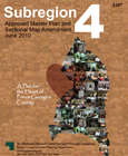
Title:
2010 Approved Subregion 4 Master Plan and Sectional Map Amendment
Author:
The Maryland-National Capital Park and Planning Commission
Prince George's County Planning Department
Publication Date:
06/01/2010
Source of Copies:
The Maryland-National Capital Park and Planning Commission
14741 Governor Oden Bowie Drive
Upper Marlboro, MD 20772
Number of Pages:
676
This document contains text and maps of the approved master plan and sectional map amendment (SMA) for the Subregion 4 area. It implements the recommendations of the 2002 Prince Georges County Approved General Plan; replaces the 1985 Approved Master Plan for Suitland-District Heights and Vicinity, Planning Areas 75A and 75B and the 1993 Approved Master Plan and Sectional Map Amendment for Landover and Vicinity (Planning Area 72); and updates the 2000 Approved Sector Plan and Sectional Map Amendment for the Addison Road Metro Town Center and Vicinity and the 2004 Approved Sector Plan and Sectional Map Amendment for Morgan Boulevard and Largo Town Center Metro Areas. It also builds upon the 2006 Central Avenue Corridor Development Strategy Planning Study, the 2007 Greater Central Avenue Public Facilities Implementation Plan, the 2009 Approved Landover Gateway Area Sector Plan and Sectional Map Amendment, the 2010 Approved New Carrollton Transit District Development Plan (TDDP) and Transit District Overlay Zoning (TDOZ) Map Amendment, the 2005 Approved Sector Plan and Sectional Map Amendment for the Tuxedo Road/Arbor Street/Cheverly Metro Area, the 2006 Approved Suitland Mixed-Use Town Center Development Plan, the 2007 Capitol Heights Approved TDDP and TDOZ Map Amendment, and the 2009 Approved Marlboro Pike Sector Plan and Sectional Map Amendment. Developed with input from the community, this document recommends goals, policies, strategies, and actions pertaining to development patterns, zoning, environmental infrastructure, transportation systems, public facilities, parks and recreation, economic development, historic preservation, and urban design. The SMA, through zoning changes, implements the recommendations of the master plan.
Approved Sector Plan and Sectional Map Amendment for the Morgan Boulevard and Largo Town Center Metro Areas

Title:
Approved Sector Plan and Sectional Map Amendment for the Morgan Boulevard and Largo Town Center Metro Areas
Author:
The Maryland-National Capital Park and Planning Commission
Prince George's County Planning Department
Publication Date:
05/01/2004
Source of Copies:
The Maryland-National Capital Park and Planning Commission
14741 Governor Oden Bowie Drive
Upper Marlboro, MD 20772
Number of Pages:
196
This document contains text and maps of the Approved Sector Plan and Sectional Map Amendment for Morgan Boulevard and Largo Town Center Metro Areas. The plan will amend portions of the 1993 Approved Master Plan and Sectional Map Amendment for Landover and Vicinity, the 1990 Approved Master Plan Amendment and Adopted Sectional Map Amendment for Largo-Lottsford, and the 1986 Approved Master Plan and Adopted Sectional Map Amendment for Suitland-District Heights and Vicinity. Developed by the Commission, with the assistance of the community, this document describes existing plans and policies for the area; analyzes land use, zoning, environment, population, urban design and public facilities; and proposes flexible land use and zoning regulations to promote transit-oriented development in proximity to the Morgan Boulevard and Largo Town Center Metro Stations. The document includes a sectional map amendment (SMA), a Development District Overlay Zone (DDOZ) containing design standards and a table of uses. These zoning tools will implement the plan’s land use and community character recommendations.
Approved Sector Plan and Sectional Map Amendment for the East Glenn Dale Area (Portions of Planning Area 70)

Title:
Approved Sector Plan and Sectional Map Amendment for the East Glenn Dale Area (Portions of Planning Area 70)
Author:
The Maryland-National Capital Park and Planning Commission
Prince George's County Planning Department
Publication Date:
03/01/2006
Source of Copies:
The Maryland-National Capital Park and Planning Commission
14741 Governor Oden Bowie Drive
Upper Marlboro, MD 20772
Number of Pages:
92
Published in 2006 and amended in April 2018, this document contains text and maps of the Approved Sector Plan and Sectional Map Amendment (SMA) for the East Glenn Dale Area. The plan amends portions of the 1993 Approved Master Plan and Sectional Map Amendment for Glenn Dale-Seabrook-Lanham and Vicinity (Planning Area 70). Developed with the assistance of the community, this document recommends goals, strategies, and actions pertaining to land use, zoning, environment, parks and recreation, transportation, trails, public facilities, historic preservation, and urban design. The SMA proposes zoning changes to implement the sector plan’s recommendations.
Approved Public Safety Facilities Master Plan

Title:
Approved Public Safety Facilities Master Plan
Author:
The Maryland-National Capital Park and Planning Commission
Prince George's County Planning Department
Publication Date:
03/01/2008
Source of Copies:
The Maryland-National Capital Park and Planning Commission
14741 Governor Oden Bowie Drive
Upper Marlboro, MD 20772
Number of Pages:
110
The plan amends the 1990 Approved Public Safety Master Plan and the 2002 Prince George’s County Approved General Plan. This plan also amends public facility-related portions of the 1990 Largo-Lottsford Approved Master Plan, 1993 Landover and Vicinity Approved Master Plan, 1993 Subregion V Approved Master Plan, 1994 Bladensburg, New Carrollton and Vicinity (PA 69) Approved Master Plan, 1994 Melwood/Westphalia Approved Master Plan, 1994 Planning Area 68 Approved Master Plan, 1994 Subregion VI Study Area Approved Master Plan, 2000 The Heights and Vicinity Approved Master Plan, 2004 Approved Prince George’s County Gateway Arts District Sector Plan, 2006 Bowie and Vicinity Approved Master Plan, 2006 East Glenn Dale Area Approved Sector Plan, 2006 Henson Creek-South Potomac Approved Master Plan, 2007 Bladensburg Town Center Approved Sector Plan, and 2007 Westphalia Approved Sector Plan. The plan contains goals, objectives, policies, and recommendations for each public safety agency. The agencies addressed by the plan are the Prince George’s County Police Department, Fire and Emergency Medical Services Department, Department of Corrections, Office of the Sheriff, M-NCPPC Park Police Division, and the Office of Emergency Management. The plan addresses the need for new facilities, renovation of facilities, staffing levels, and crime prevention strategies such as Crime Prevention through Environmental Design (CPTED) and a proposal for a crime prevention surcharge.
Related Documents:
Acknowledgments
Additional Public Safety Recommendations
Appendices
Department of Corrections
errata
Fire EMS Department Facility Recommendations
Goals and Objectives
Introduction
Maps
Office of the Sheriff
Police Department Recommendations
Prince George's County Fire EMS Department
Prince George's County Police Department
Proposed Public Safety Training Facility
Summary of Recommendations