Publications
Image Carousel
Publications Information
Potential Greenbelt Historic District Design Guidelines Draft
Title:
Potential Greenbelt Historic District Design Guidelines Draft
Author:
The Maryland-National Capital Park and Planning Commission
Prince George's County Planning Department
Source of Copies:
The Maryland-National Capital Park and Planning Commission
14741 Governor Oden Bowie Drive
Upper Marlboro, MD 20772
Number of Pages:
166
This Potential Greenbelt Historic District Design Guidelines study was undertaken by the Prince Georges County Planning Department at the request of the City of Greenbelt through the Planning Assistance to Municipalities and Communities program (Fiscal Year 1997). The document that follows was produced by the Planning Departments Historic Preservation Section and Urban Design Planning Division in coordination with the Greenbelt Homes, Inc., (GHI) Ad Hoc Historic District Study Committee. The purpose of the document is to put forth all of the procedures and standards that would affect property owners if a locally designed historic district were established in Greenbelt.
Related Documents:
2008 Approved Branch Avenue Corridor Sector Plan and Sectional Map Amendment
Title:
2008 Approved Branch Avenue Corridor Sector Plan and Sectional Map Amendment
Author:
The Maryland-National Capital Park and Planning Commission
Prince George's County Planning Department
Publication Date:
09/01/2008
Source of Copies:
The Maryland-National Capital Park and Planning Commission
14741 Governor Oden Bowie Drive
Upper Marlboro, MD 20772
Number of Pages:
168
The Approved Branch Avenue Corridor Sector Plan and Sectional Map Amendment comprises text, maps, illustrations, and pictures. The sector plan amends portions of the 2000 Approved Master Plan and Sectional Map Amendment for the Heights and Vicinity (Planning Area 76A) and the 2002 Prince George’s County Approved General Plan. Developed with broad public participation, this document presents background information, the vision for the area, and a discussion of the five elements that frame the vision-Land Use and Economic Development, Design and Appearance, Infrastructure to Support the Plan, Quality of Life, and Community Involvement. The plan recommends the designation of the Naylor Road Metro Station as a Regional Center with a mixed use, high-density residential/office/retail land use classification, and the Iverson-Marlow Heights Mixed-Use Center as a node on the Branch Avenue Corridor with a mixed-use, medium-density residential/office/ retail land use classification. The plan contains policies and strategies for land use, economic development, urban design, parks and recreation, transportation systems (including roadways, transit, bicycle, pedestrian, and trail facilities), revitalization, public safety, and community involvement. The overall objective of these policies and strategies is to revitalize and redevelop the sector plan area, thereby improving its visual appeal and providing pedestrian- and transit-oriented, mixed-use development that will create a positive sense of place and attract new residents, quality retail, and jobs while preserving and strengthening the existing residential neighborhoods. The sectional map amendment (SMA) contains zoning changes to allow implementation of the plan vision and the land use concepts in the sector plan.
Related Documents:
 BAC_1_cover_front
BAC_chapter1_and_2_Introduction
BAC_chapter3_a_Analysis
BAC_chapter3_b_Analysis
BAC_chapter4_Vision
BAC_chapter5_a_Action_Plan
BAC_chapter5_b_Action_Plan
BAC_chapter5_c_Action_Plan
BAC_chapter6_a_Sectional_Map_Amendment
BAC_chapter6_b_Sectional_Map_Amendment
BAC_chapter6_c_Sectional_Map_Amendment
BAC_chapter6_d_Sectional_Map_Amendment
BAC_chapter7_Timeline_and_appendices
BAC_1_cover_front
BAC_chapter1_and_2_Introduction
BAC_chapter3_a_Analysis
BAC_chapter3_b_Analysis
BAC_chapter4_Vision
BAC_chapter5_a_Action_Plan
BAC_chapter5_b_Action_Plan
BAC_chapter5_c_Action_Plan
BAC_chapter6_a_Sectional_Map_Amendment
BAC_chapter6_b_Sectional_Map_Amendment
BAC_chapter6_c_Sectional_Map_Amendment
BAC_chapter6_d_Sectional_Map_Amendment
BAC_chapter7_Timeline_and_appendices
Plan Prince George's 2035 Approved General Plan Five-Year Evaluation (2019)

Title:
Plan Prince George's 2035 Approved General Plan Five-Year Evaluation (2019)
Author:
The Maryland-National Capital Park and Planning Commission
Prince George's County Planning Department
Source of Copies:
The Maryland-National Capital Park and Planning Commission
14741 Governor Oden Bowie Drive
Upper Marlboro, MD 20772
Number of Pages:
78
A comprehensive 20-year general plan, the 2014 Plan Prince George’s 2035 Approved General Plan (Plan 2035) articulates a shared vision for making Prince George’s County a competitive force in the regional economy, a leader in sustainable growth, a community of strong neighborhoods and municipalities, and a place where residents are healthy and engaged. Plan 2035 specifies indicators of success and growth management targets to measure progress toward the vision and goals described in Plan 2035. This 2019 Plan 2035 Five-Year Evaluation Report quantifies the indicators of success and identifies where progress has been made and where improvements are needed. The report measures the growth management policy regarding dwelling units and jobs targets by growth policy areas.
 Plan 2035
1994 Planning Area 68 Approved Master Plan and Sectional Map Amendment
Title:
1994 Planning Area 68 Approved Master Plan and Sectional Map Amendment
Author:
The Maryland-National Capital Park and Planning Commission
Prince George's County Planning Department
Source of Copies:
The Maryland-National Capital Park and Planning Commission
14741 Governor Oden Bowie Drive
Upper Marlboro, MD 20772
Number of Pages:
170
This document contains maps and supporting text of the Approved Planning Area 68 Master Plan and the Adopted Sectional Map Amendment (SMA). The Plan supersedes the 1974 Planning Area 68 Master Plan. The zoning proposals contained herein supersede the 1982 SMA. This Plan is also an amendment to The General Plan for the Maryland-Washington Regional District within Prince George’s County, Maryland, approved by the County Council in 1982; the 1983 Master Plan for Public School Sites; the 1992 Historic Sites and Districts Plan; the 1975 Countywide Trails Plan (including the 1985 Equestrian Addendum); the 1982 Master Plan of Transportation; and the 1990 Public Safety Master Plan. Developed by the Commission with the assistance of the Planning Area 68 Citizens Advisory Committee and other interested community participants, the Plan includes a vision for the future of the community developed by the committee. It also includes an historical overview and a community profile of the development of the communities of the Planning Area. Planning themes which were identified for the Planning Area include community reinvestment, transportation and natural resources. The central theme established for the Plan is to create a supportive and committed partnership among representatives from County and local government, residents and businesses to develop and implement strategies that improve the community. Goals, objectives and recommendations to guide public policy and investment in the Planning Area are presented for the eight major elements of the Plan: residential neighborhoods, commercial areas, industrial employment centers, the transportation and circulation network, the trails system, parks and recreation, natural resources and public facilities. Since a major focus of the Plan is on revitalization, specific recommendations addressing community revitalization needs are presented, including two new zones for the US 1 corridor. Detailed revitalization plans are also presented for the Hyattsville, Mount Rainier and Riverdale Town Centers and for the Brentwood and North Brentwood Industrial Employment District. Specific action steps are identified to implement major plan recommendations. The SMA includes other zoning changes which are also designed to implement the Plan’s recommendations.
Related Documents:
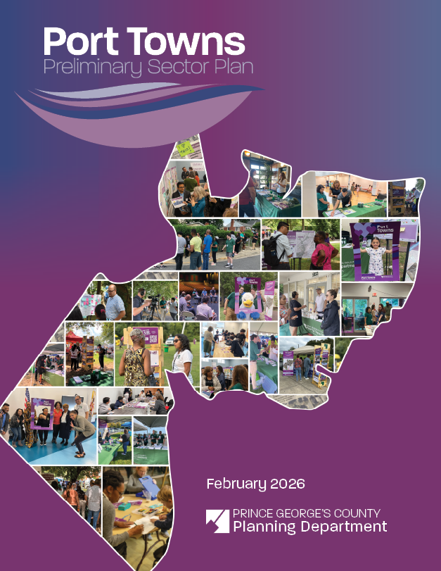
Port Towns Plan Summary Document
Title:
Port Towns Plan Summary Document
Author:
The Maryland-National Capital Park and Planning Commission
Prince George's County Planning Department
Source of Copies:
The Maryland-National Capital Park and Planning Commission
14741 Governor Oden Bowie Drive
Upper Marlboro, MD 20772
Number of Pages:
12
The sector plan area, which is located in portions of Planning Areas 68 and 69, generally comprises the properties contained within the municipal boundaries of Bladensburg, Colmar Manor, Cottage City, and Edmonston, as well as properties south of the Bladensburg municipal boundary from the south side of Annapolis Road to the BaltimoreWashington Parkway (excluding the properties within the Cheverly municipal boundary) east to the Colmar Manor municipal boundary, and properties east of the Edmonston municipal boundary and north and west of the Bladensburg boundary to Carters Lane. The sector plan area is largely residential, but also contains a mix of other uses, including several shopping centers, employment areas, and portions of the Northeast and Northwest Branches of the Anacostia River.
Related Documents:
Postbellum Archeological Resources in Prince George's County, Maryland A Historic Context and Research Guide
Title:
Postbellum Archeological Resources in Prince George's County, Maryland A Historic Context and Research Guide
Author:
The Maryland-National Capital Park and Planning Commission
Prince George's County Planning Department
Source of Copies:
The Maryland-National Capital Park and Planning Commission
14741 Governor Oden Bowie Drive
Upper Marlboro, MD 20772
Number of Pages:
210
Prince George’s County adopted subdivision regulations in 2005 that were intended to ensure that archeological sites deemed significant to understanding the history of human settlement in the county be identified as part of the subdivision review process. Historic sites dating to the late-nineteenth and early-twentieth centuries (circa 18651958) are one of the most common categories of resources identified in archeological surveys in the county, with over 300 examples in the Maryland Historical Trust (MHT) site files as of October 2007. However, additional investigations are being recommended at few, if any, of these sites. Still this time period witnessed many changes, including the subdivision of large plantations, significant changes in the relations of production, establishment of African-American-owned farms and communities, new technologies, transportation enhancements, and the growth of suburbia. Nevertheless, the contribution of the late-nineteenth and early-twentieth century archeological sites to the understanding of these changes in Prince George’s County is either unknown or unappreciated.
Related Documents:
A Cover 1
Chapter 0 Table of Contents
Chapter 01 Introduction
Chapter 02 Geographic and Historical Overview
Chapter 03 Agriculture
Chapter 04 Industry and Services
Chapter 05 Military Facilities
Chapter 06 The African-American Experience
Chapter 07 Government Facilities
Chapter 08 Transportation
Chapter 09 Settlement
Chapter 10 Registration Requirements
Chapter 11 References Cited
Chapter 12 Appendix A
Chapter 13 Appendix B
Cover 3 Acknowledgements
Plan Prince George's 2035 Approved General Plan

Title:
Plan Prince George's 2035 Approved General Plan
Author:
The Maryland-National Capital Park and Planning Commission
Source of Copies:
The Maryland-National Capital Park and Planning Commission
14741 Governor Oden Bowie Drive
Upper Marlboro, MD 20772
Number of Pages:
322
Plan Prince George’s 2035 includes comprehensive recommendations for guiding future development within Prince George’s County. The plan designates eight Regional Transit Districts, which are the focus of the County’s planned growth and mixed-use development, and which have the capacity to become major economic generators. Six Neighborhood Reinvestment Areas are designated for coordinated funding and resources needed to stabilize and revitalize these areas. Also identified in the plan are Rural and Agricultural Areas composed of low-density residential, agricultural uses, and significant natural resources that are recommended for continued protection and investment in order to maintain critical infrastructure. The plan contains recommended goals, policies, and strategies for the following elements: Land Use; Economic Prosperity; Transportation and Mobility; Natural Environment; Housing and Neighborhoods; Community Heritage, Culture, and Design; Healthy Communities; and Public Facilities. Plan implementation through prioritization of strategies, measuring short- and long-term success, public and municipal engagement, intergovernmental coordination, and public-private partnerships are also described.
Approved Bowie State MARC Station Sector Plan and Sectional Map Amendment

Title:
Approved Bowie State MARC Station Sector Plan and Sectional Map Amendment
Author:
The Maryland-National Capital Park and Planning Commission
Publication Date:
01/01/2010
Source of Copies:
The Maryland-National Capital Park and Planning Commission
14741 Governor Oden Bowie Drive
Upper Marlboro, MD 20772
Number of Pages:
138
This document is the sector plan and sectional map amendment for the Bowie State MARC Station area. The plan amends portions of the 2006 Approved Master Plan for Bowie and Vicinity and Sectional Map Amendment for Planning Areas 71A, 71B, 74A, and 74B. Developed with the assistance of the community, this document recommends goals, strategies, and action pertaining to land use, zoning, environment, parks and recreation, transportation, trails, public facilities, historic preservation, urban design, economic development, and sustainability. The SMA zoning changes implement the sector plan.
Approved Bladensburg Town Center Sector Plan and Sectional Map Amendment
Title:
Approved Bladensburg Town Center Sector Plan and Sectional Map Amendment
Author:
The Maryland-National Capital Park and Planning Commission
Prince George's County Planning Department
Publication Date:
06/01/2007
Source of Copies:
The Maryland-National Capital Park and Planning Commission
14741 Governor Oden Bowie Drive
Upper Marlboro, MD 20772
Number of Pages:
150
This document is the sector plan and proposed sectional map amendment (SMA) for the Bladensburg Town Center area. The plan and SMA amends portions of the 1994 Approved Bladensburg-New Carrollton and Vicinity Master Plan and Sectional Map Amendment (Planning Area 69). Developed with the assistance of the community, this document recommends goals, policies, strategies, and actions pertaining to development patterns, zoning, environmental infrastructure, transportation systems, public facilities, parks and recreation, economic development, historic preservation, and urban design. The SMA proposes zoning changes to implement the recommendations of the sector plan.
2001 Approved Anacostia Trails Heritage Area Management Plan: Public Summary

Title:
2001 Approved Anacostia Trails Heritage Area Management Plan: Public Summary
Author:
The Maryland-National Capital Park and Planning Commission
Prince George's County Planning Department
Publication Date:
09/01/2001
Source of Copies:
The Maryland-National Capital Park and Planning Commission
14741 Governor Oden Bowie Drive
Upper Marlboro, MD 20772
Number of Pages:
20
This management plan describes the heritage tourism program for the Anacostia Trails Heritage Area (ATHA) in northern Prince George’s County. ATHA is a territory of some 83.7 square miles, encompassing 14 municipalities as well as many neighborhoods in the unincorporated portions of the county. It is bounded on three sides by the county border and on the east, in part, by the Baltimore-Washington Parkway and in part by a line further east following federal land ownership to the Patuxent River, the county’s northern and eastern boundary. The federal, state and local governments own 38 percent of the land in ATHA.
Related Documents: