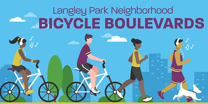
Langley Park Neighborhood Bicycle Boulevards
Langley Park Neighborhood Bicycle Boulevards Details
Updates
The Langley Park Neighborhood Bicycle Boulevards report is now available. Please view or download a copy here.
Thank you to all those who were able to attend our Virtual Community Meeting on Thursday, March 18th, 2021. For those who could not attend, the presentation materials and recordings from the meeting are available for viewing from the links below.
In 2020, Prince George’s County received a Metropolitan Washington Council of Governments (MWCOG) grant via the Transportation Land-Use Connections (TLC) Program in the amount of $80,000, towards technical assistance to develop engineering plans for bicycle lanes and shared use roads on several local streets in the Langley Park area. The streets feed into the intersection of MD 212 (Riggs Road) and MD 193 (University Boulevard), the location of a proposed Purple Line Station.
The incoming Purple Line Station at Riggs Road presents an opportunity to improve pedestrian and bicycling facilities, to provide better connectivity to public transit, and improve multimodal transportation options. Providing options to bridge the last/first-mile gap, will make Purple Line transit use more convenient for future riders that live, work, and visit the area.
This project will serve to provide safe and convenient access for multiple modes of transportation (i.e. pedestrians, bicycles, buses, and motorists).
Specific benefits would include:
- Increase walkability by enhancing safety and convenience and strategically improving streets to accommodate all users.
- Ensure pedestrian and bicycle access to the Purple Line transit system specifically Riggs Road Station.
- Provide access to transit facilities for the full range of users
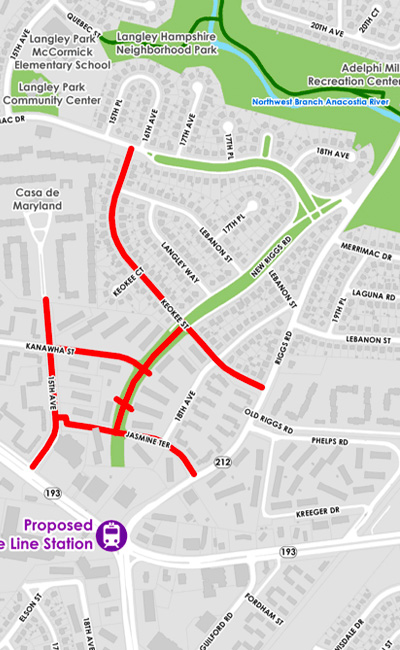
The Prince George’s County Planning Department needs your input on the Langley Park Neighborhood Bicycle Boulevards project. This project will guide complete streets development in the Langley Park neighborhood north of the Riggs Road Purple Line station.
Use this interactive web map (English or Spanish) to submit comments on locations with traffic safety or pedestrian/bicycle crossing issues.
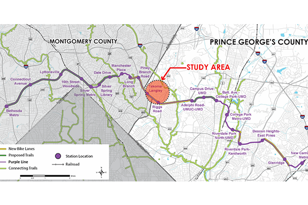
Study-Area
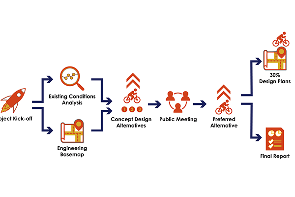
Planning Process
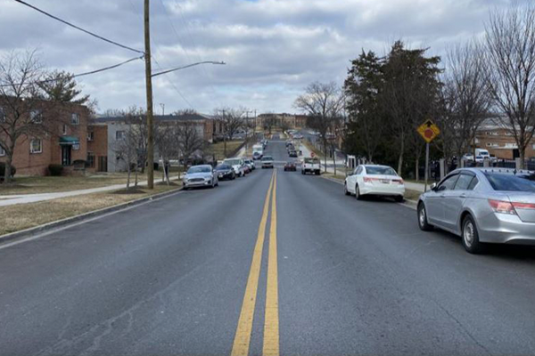
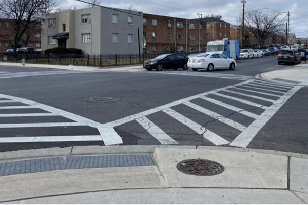
15th Street and New Riggs Road Existing Conditions
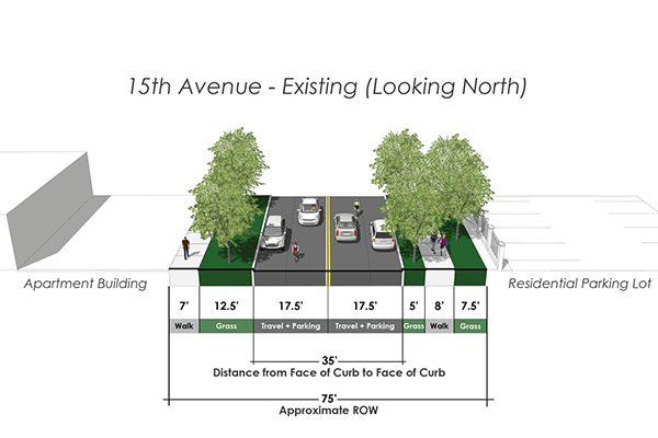
15th Avenue and New Riggs Road Existing Conditions Sketch
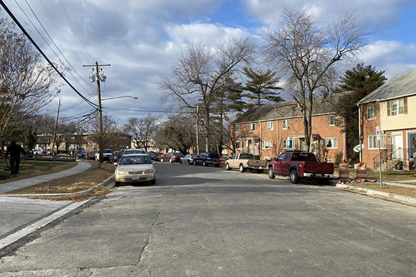
Jasmine Terrace Existing Conditions
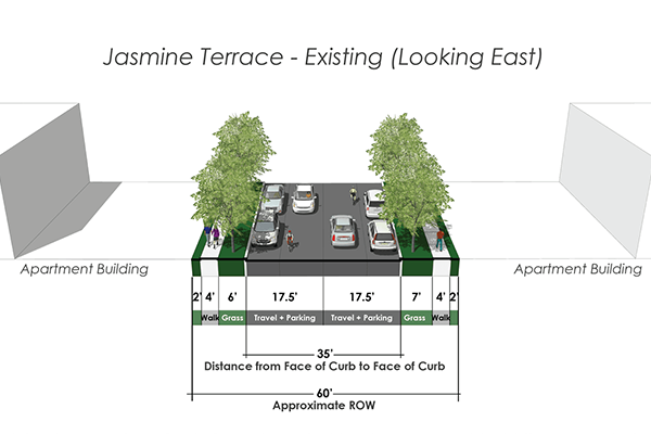
Jasmine Terrace Existing Conditions Sketch
Kanahwa Street Existing Conditions
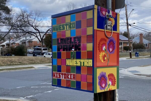
Langley Park Neighborhood Artwork
Timeline
Task: Due Date
Project Initiation: November 2020
- Existing Conditions Analysis: December 2020 – January 2021
- Concept Design Alternatives: February – March 2021
- Public Meeting: March 2021
- Design Plan Sets & Cost Estimates: April – May 2021
- Final Report & Plans: June 2021