Prince George’s County Development Pipeline
Data valid through August 2024
The Prince George’s County Planning Department tracks the County’s residential and nonresidential development pipeline (the City of Laurel is excluded). “Development Pipeline” refers to development approved by the Prince George’s County Planning Board and/or Planning Director but is yet to be built. It provides insights into short- to medium-term development, helping stakeholders such as planners, developers, policymakers, and the public stay aware of changing land uses, particularly related to the county’s housing stock and commercial uses.
Links
Interactive Development Pipeline Dashboard
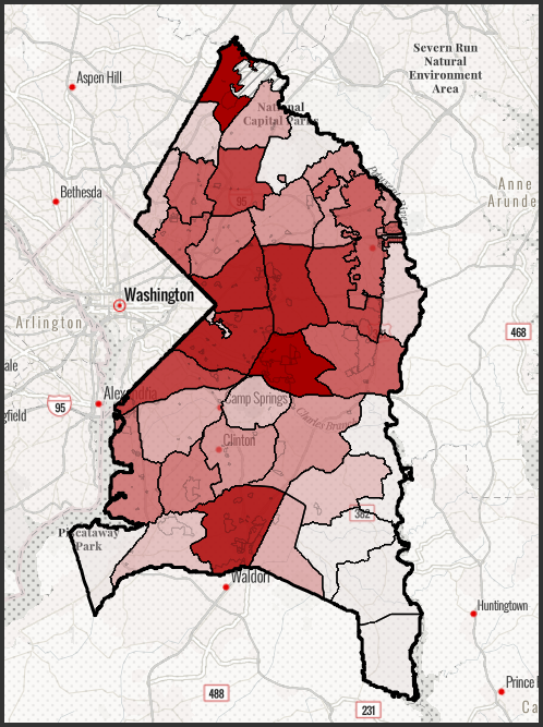
An interactive dashboard showcases the development pipeline for active projects within the county. Presented on a map divided into the county’s 36 Planning Areas, the dashboard provides a comprehensive overview of the county’s near-term development trajectory, including project-based data and visualizations of development patterns.
Analysis/Generation of Pipeline Data
The generation of pipeline data is a methodical process that involves sourcing and compiling information from approved development applications. This includes detailed commercial and residential development data, tracking approval statuses, and identifying prevailing information for accurate tabulations. The use of high-definition aerial imagery, county GIS, and permit data ensures precise determination of built quantities. These processes, performed on a project basis, culminate in a comprehensive dataset that reliably tracks development progress throughout the county.
Data Accuracy and Updates
The Development Pipeline data is a dynamic entity, constantly evolving as construction progresses, new development applications are received, projects are amended or rebranded, and establishments change status. To maintain the accuracy and currency of the project database, updates are planned on a six-month to one-year cycle. We welcome any comments, suggestions, or suspected errors, which can be submitted via email request to PPD-PipelineServices@ppd.mncppc.org.
The data provided is intended for general analysis purposes, offering a broad overview of the county’s development landscape. For more detailed information about a project or site, please refer to the specific plans or approved permits, as they provide more comprehensive details beyond the scope of this tool.