Flooding & Stormwater Hazard Mitigation Analysis for Brentwood & North Brentwood (PAMC)
Flooding & Stormwater Hazard Mitigation Analysis for Brentwood & North Brentwood (PAMC)
Update
At a public meeting hosted by the Town of Brentwood on May 01, 2025, consultants Charles P. Johnson and Associates presented the Draft Flooding and Stormwater Hazard and Risk Management Analysis for the Towns of Brentwood and North Brentwood.
Project Planner
Anusree Nair
Planner II, Neighborhood Revitalization Section
PHONE: 301-780-2233
EMAIL: anusree.nair@ppd.mncppc.org
Project Description
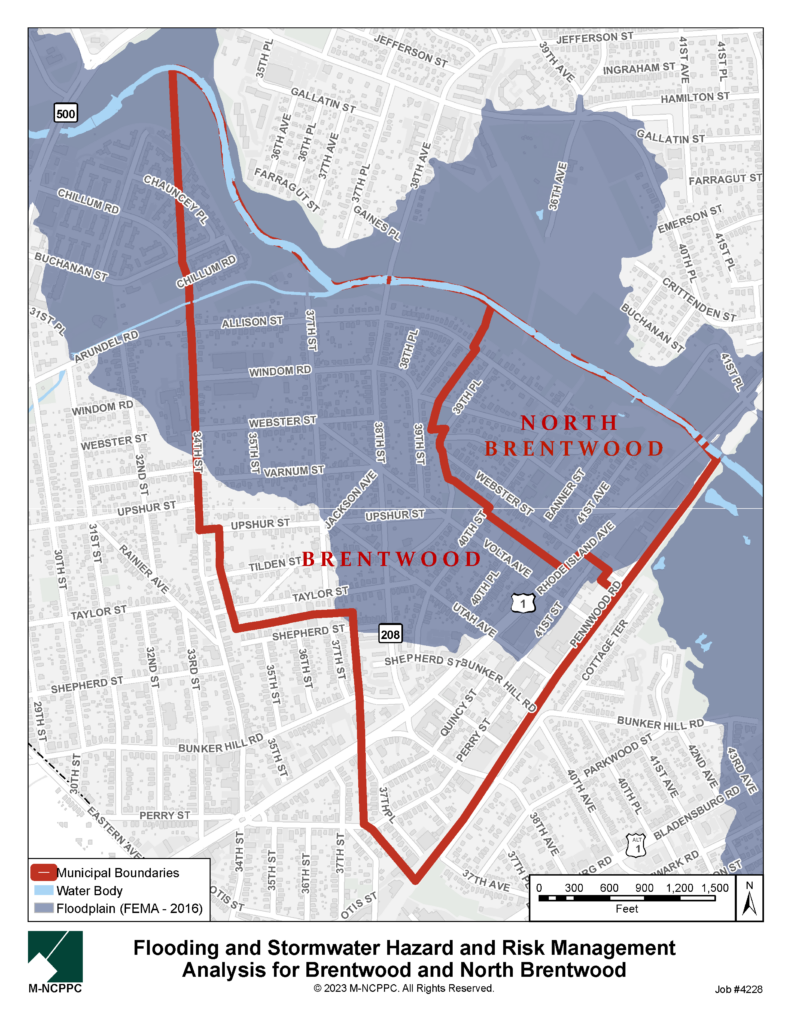
Located within the Anacostia Watershed along the Northwest Branch of the Anacostia River, approximately 164 acres, or 66 percent, of improved properties in the Town of Brentwood and 70 acres, or virtually 100 percent, of those in the Town of North Brentwood are located in a FEMA-designated flood zone, which does not account for climate change events. Although some work has been undertaken to identify which properties are prone to flooding and what causes it, and to mitigate it through infrastructure improvements, the towns lack a comprehensive understanding of current conditions and future predictions. Residents regularly experience flooding with extreme rain events, sometimes creating or exacerbating financial hardships and health problems.
The purpose of the project is to provide the towns with data and tools to assess key current and possible hydrometeorological hazards, as well as their vulnerability and options for risk reduction and mitigation, and:
- Identify all private and municipal properties, infrastructure, and natural resources with flooding and/or stormwater hazard
- Identify the causes of those risks
- Categorize properties and infrastructure by flooding and/or stormwater risk
- Identify potential mitigation measures for each category
- Identify areawide infrastructure-related potential mitigation actions and analyze the regulatory structure required to implement such actions; and
- Provide an analysis report and data that can be incorporated into the Brentwood Climate Action Plan, and used as a standalone document by both towns, working independently and together to reduce or eliminate flooding and stormwater as hazards.
Project Boundary
