Greenbelt Strategic Wayfinding Plan (PAMC)
Greenbelt Strategic Wayfinding Plan (PAMC)
Project Planner
Planner II, Neighborhood Revitalization Section
PHONE: 301-780-2233
EMAIL: anusree.nair@ppd.mncppc.org
Update
View the completed Greenbelt Strategic Wayfinding Plan.
Project Description
With the Strategic Wayfinding Plan, the City of Greenbelt seeks to orient, direct, and inform visitors and residents to both well-known and less well-known attractions within historic Greenbelt and the city as a whole. The plan will be developed with input from the City of Greenbelt’s Advisory Planning Board, Arts Advisory Board, residents, and city council.
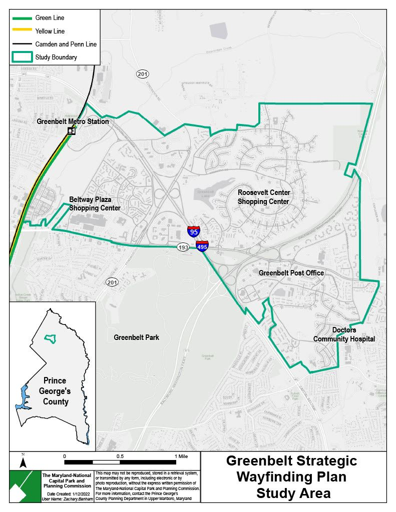
The wayfinding plan will facilitate travel to key sites by driving, walking, bicycling, or using transit by providing clear directions along safe and convenient routes. Specific attention will be given to directing residents and visitors to and around Roosevelt Center, the historic retail and cultural core of the community. Although the project is intended to comprehensively address wayfinding throughout the city, land owned and maintained by the National Park Service (for example, Greenbelt Park) is excluded from the project area.
This project shall comprise the following elements:
- Inventory of existing wayfinding features: type, location, condition
- Identification of key sites and wayfinding gaps or deficiencies
- Development of sign design concepts
- Recommendations addressing new sign locations and replacement and removal/consolidation of signage
- Preparation and presentation of the final report
Project Boundary