Transportation
Transportation Details
The PRELIMINARY GO PRINCE GEORGE’S FUNCTIONAL MASTER PLAN is available for review and comment now!
You can VIEW THE DRAFT PLAN and submit your comments to gopgc@mncppc.org. For general questions and comments, feel free to contact the Go Prince George’s Team directly.
The Planning Department is dedicated to creating a comprehensive, multimodal transportation network that enhances connectivity, safety, and sustainability for all residents. Their efforts align with the county’s broader vision of equitable and transit-oriented development.
Key Initiatives and Focus Areas
- Go Prince George’s Functional Master Plan: This preliminary plan aims to modernize the county’s transportation infrastructure by emphasizing the movement of people over vehicles. It supports the implementation of Plan 2035 and focuses on safety, innovation, sustainability, and equity. The plan is currently open for public review and comment.
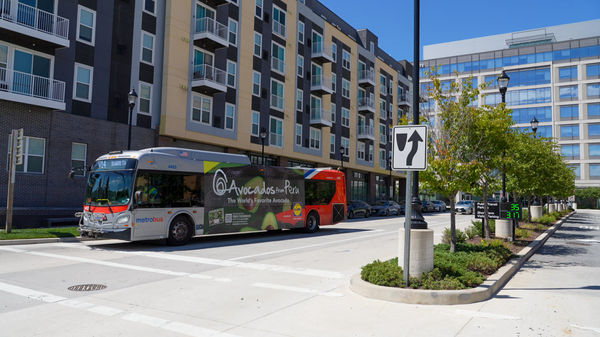
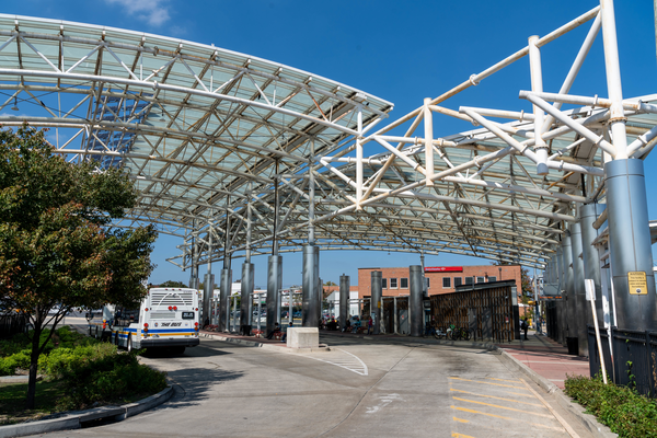
- Transit-Oriented Development (TOD): With 15 Metrorail stations and over 2,500 acres of undeveloped land within a half-mile radius of these stations, the county is well-positioned to promote mixed-use, transit-focused growth. A dedicated TOD website provides resources, station area plans, and development opportunities.
- Active Transportation: The Active Transportation Advisory Group (ATAG) convenes quarterly to address issues related to bicycle, pedestrian, and shared-use paths. The group advises on safety, access, and infrastructure improvements to support non-motorized transportation.
- Travel Demand Modeling: The county utilizes TransForM, a proprietary Travel Demand Forecasting Model, to conduct scenario-based analyses that inform master and sector plans, ensuring data-driven transportation planning.
- Site-Specific Transportation Analysis: The Transportation Planning Section evaluates development applications for traffic operations, site layout, circulation, and multimodal facilities to ensure comprehensive transportation considerations in new developments.
- Community-Based Mobility Studies: Projects like the Carole Highlands Safe Mobility Study collaborate with local communities to develop transportation solutions that enhance safety, access, and connectivity, particularly around key transit corridors like the Purple Line.
Ongoing Projects and Programs
Preliminary Go Prince George’s Master Plan of Transportation
Go Prince George's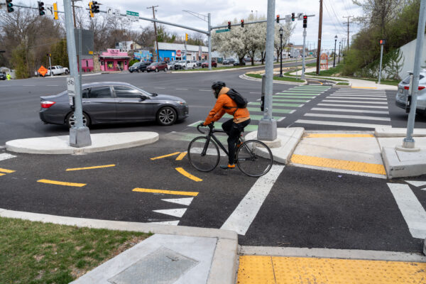
Active Transportation Advisory Group
Active Transportation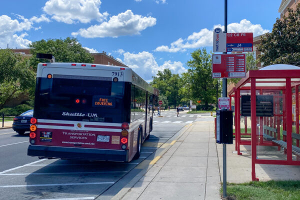
Transit-Oriented Development
Learn more
Pedestrian and Bicyclist Behavioral Study
Learn moreCompleted Studies, Reports, and Projects
- Carole Highlands Safe Mobility Study (PDF) (April 2024)
- Langley Park Neighborhood Bicycle Boulevard Project (2021)
- Prince George’s County Transitway Systems Planning Study (PDF) (June 2012)
- Central Avenue TOD Mobility Study (PDF) (March 2011)
- Naylor Road Metro Station Area Accessibility Study (PDF) (May 2011)
- Purple Line Corridor Access Study (CAST) (June 2011)
- Purple Line Bicycle Access and Bicycle Hub Location Study (PDF) (June 2010)
- New Carrollton Interim Pedestrian Safety Improvements (PDF) (June 2010)
- Town of Cheverly Non-Motorized Transportation Study (PDF) (December 2009)
- Prince George’s Plaza Metro Area Study (PDF) (August 2008)
Resources
Maps
- Joint Base Andrews Quadrant (PDF)
- Largo/Watkins Regional Park Quadrant (PDF)
- National Harbor/Oxon Hill/Forest Heights Quadrant (PDF)
- South Bowie Quadrant (PDF)
- Westphalia Quadrant (PDF)
Map Updates
These maps are maintained by staff within the Transportation Planning Section of the Countywide Planning Division. As future master plan ROWs are identified or amended through the master plan, sector plan, development review, or capital project planning processes, this coverage will be revised or maintained accordingly regularly by the Transportation Planning Section staff.
Technical Data
This layer represents an inventory of planned rights-of-way (ROW) for Prince George’s County as graphically shown in the master plans, sector plans, and the 2009 Countywide Master Plan of Transportation (MPOT). This inventory of ROW was originally created by digitizing proposed master plan alignments from 200-foot-scale paper maps. While the alignments depicted in master plans, sector plans, and the MPOT are largely illustrative and may not be considered legally sufficient, the alignments shown in the PGAtlas are drawn to scale and represent the most accurate location as intended in the master plans.
Adequate Public Facilities
A preliminary subdivision plan must accompany a traffic impact study if the proposed development generates 50 trips or more during peak hours. Traffic studies for proposed developments of this size or larger are prepared by the applicant and reviewed by staff to enable the Planning Board to make the required findings regarding the adequacy of transportation facilities in the Subdivision Ordinance. In cases where a development generates fewer than 50 trips, the transportation staff must still review the preliminary plan in order for the Planning Board to make the required findings and may request (but not require) a limited traffic study or traffic counts to assist in making these findings. Developments generating five or fewer peak-hour trips may be deemed to have a minimal, or de minimis, impact, and if so deemed, are not required to provide traffic-related information.
Guidelines
The Planning Board publishes the Guidelines for the Analysis of the Traffic Impact of Development Proposals (Guidelines). This document establishes criteria by which staff and applicants with land development proposals can assess the traffic impact of the development proposals and incorporates methods and practices currently being used to review and evaluate traffic conditions.
Reviews
Traffic is also reviewed in detail during the review of mixed-use and comprehensive design rezoning applications. Certain types of special exceptions require limited traffic analyses, but in accordance with the required special exception findings, such studies often focus on traffic safety. As noted earlier, detailed site plans are intended to review design issues and, as such, generally do not involve the review of transportation adequacy issues.
Transit-Oriented Development
Prince George’s County is uniquely situated in the Washington region to exploit the regional interest in transit-oriented development. The county is home to 15 of the region’s 86 Metrorail stations. Within one-half mile of the county’s Metrorail stations are over 2,500 acres of undeveloped land, providing ample opportunities for innovative, mixed-use development with a strong emphasis on transit-oriented design. While many Metrorail stations are over capacity, 11 of 15 stations in Prince George’s County have the capacity to absorb additional Metrorail ridership growth.
Prince George’s County Planning has developed a dynamic website that allows you to learn about transit-oriented development (TOD) in the county. The TOD website is a user-friendly tool that provides information and access to the county’s TOD efforts. There, you will find useful links, plans, and Metro station area facts for the 15 stations located in Prince George’s County. We encourage you to ask questions.
Urban Design Standards
Long-Range Transportation Planning

The Long-Range Transportation team provides assistance in the County’s long-range planning efforts, including:
- Review and preparation of the transportation infrastructure section for all master plans, general plans, and sector plans;
- Maintenance and application of the County’s long-range forecast model;
- Assistance in County Map Amendments and Sector Plan Amendments;
- Review of Mandatory Referral applications and Clearinghouse requests;
- Other special assignments/requests as they relate to long-range planning.
About the Transportation Planning Team
The Planning Department employs two separate teams to encourage efficient and effective delivery of the goals and objectives of the Transportation Planning section. In addition, the section has a full-time Pedestrian/Bicycle Coordinator who is responsible for assisting in all aspects of active transportation planning.
Duties and Responsibilities
- Coordinate regional transportation planning policy analysis with transportation operating and planning agencies, including the Prince George’s County Department of Public Works and Transportation, the Maryland Department of Planning, the Maryland Department of Transportation, the National Capital Region Transportation Planning Board, and the Washington Metropolitan Area Transit Authority.
- Mandatory Referrals from federal, state, and county agencies.
- Develop, evaluate, and maintain updates of the transportation recommendations in master plans, sector plans, and the Approved Countywide Master Plan of Transportation (2009).
- Evaluate and review public and private development projects and their impacts on the adequacy of the transportation system for the Planning Board and County Council.
- Provide strategic transportation planning, programming, and policy technical support to municipal, county, and state agencies.
- Coordinate with municipal, county, regional, state, and federal transportation and planning agencies to implement the recommendations of master plans, sector plans, and the Countywide Master Plan of Transportation (2009).
Long-Range Planning Team
The Transportation Planning Service (TPS) Supervisor provides technical assistance to the Long-Range Planning staff. He or she also represents TPS in outreach meetings with citizens and other stakeholders. TPS approval is required for all scopes of services and billing for long-range transportation planning contracts.
The Long-Range Team Lead represents TPS in organizational meetings with the Community Planning Division and delegates assignments to Long-Range Planners. Reviews all scope of services and billing for all Long-Range Planning contracts; supports Long-Range planners in Planning Board or Council hearings or briefings when necessary.
The Transportation Modeler manages the County’s Transportation Planning Travel Demand Forecasting Model serves as the liaison to the Department, County, and all external agencies. Assists the TPS Long Range Planners and Community Planning Division staff with applying transportation demand modeling for long-range planning projects.
The Long-Range Planner manages TPS long-range planning efforts and is a liaison and resource to the Community Planning Division. Reviews technical analysis associated with long-range community planning projects; represents TPS in outreach meetings with citizens and other stakeholders. Drafts all correspondence, final memos, or technical reports when needed.
Site Analysis Team
The Transportation Planning Service (TPS) Supervisor provides approval for final memos (“referrals”); represents TPS in pre-application conferences when needed; provides technical assistance to Site Analysis Team reviewers; and supports the Team Lead and Site Analysis Team reviewers in PB or Council public hearings/briefings when necessary.
Site Analysis Team Lead serves as the primary representative for TPS in pre-application conferences and conducts pre-acceptance reviews of development applications; assigns development applications to reviewers; supports DRD reviewers in PB or Council hearings or briefings when necessary.
The Reviewer carries out technical analysis associated with development applications for Dundee and a comprehensive multi-modal transportation planning analysis of development applications.
Pedestrian and Bicycle Coordinator
The Pedestrian and Bicycle Coordinator leads all bicycle and pedestrian planning efforts for TPS. Duties include, but are not limited to, representing TPS in outreach meetings with citizens and other stakeholders. The coordinator also serves as the liaison to the Department, County, and external agencies regarding Ped-Bike efforts and projects.
Need Help? Contact Us
PHONE: 301-952-3680
FAX: 301-952-3749
PHONE: 301-952-3084